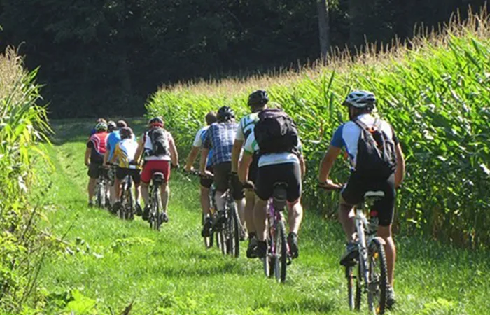
The total length of the 1st stage of the EuroVelo priority 1st track, one of the Ephesus – Mimas cycling routes, is 77.4 kilometers. The route starts from Çeşme İskele and ends at Urla İskele, at the entrance of the ancient city of Klazomenae. The route, whose highest point is Kadıovacık village at 297 meters, passes from the back of Çeşme, on low-traffic roads, to Alaçatı via Ovacık Village, and from there to Ildırı from Şifne.
The total length of the EuroVelo priority 1st stage and 2nd track of the Ephesus – Mimas cycling routes is 61.3 kilometers. The route starts from Urla Iskele and ends at the ancient city of Lebedos in Ürkmez.
The total length of the 1st stage and 3rd track of the EuroVelo priority Ephesus – Mimas cycling routes is 52.1 kilometers. It starts in the ancient city of Lebedos in Ürkmez and ends in Selçuk, at the entrance of the ancient city of Ephesus. The route, whose highest point is 88 meters, starts from the center of Ürkmez and proceeds on a round-trip vehicle road until the Selçuk – Kuşadası junction.
The total length of the 2nd stage 1st track of the Ephesus – Mimas cycling routes is 30.7 kilometers. It starts from Çeşme Port and joins the EMY 1 route in Alaçatı.
The total length of the second stage of the Ephesus – Mimas cycling routes is 36.8 kilometers. The route starts from Çeşme Port and merges with the EMY 1 route at Uzunkuyu Village.
The total length of the 2nd track of the 4th stage of the Ephesus – Mimas cycling routes is 58.2 kilometers. Starting from Bademler Village, the route connects to Yelki – Güzelbahçe district center and Gödence through Küçükkaya and Efemçukuru villages. The highest point reached on the route is the radar site with 961 meters.
The total length of the 4th stage 3rd track of the Ephesus – Mimas cycling routes is 86.5 kilometers, and the altitude at the highest point of the route is 500 meters. The route, which starts in Seferihisar, passes through the hot spring region, Kocaçay Valley and the valleys feeding the Beyler Dam, and ascends in Gödence. Heading west and losing altitude, it connects to Düzce Village and then to Seferihisar, through the Almonds and tangerine gardens.
The total length of the 2nd stage 3rd track of the Ephesus – Mimas cycling routes is 32.6 kilometers and the highest point is 245 meters. The track, which starts with the EMY 1 route in Alaçatı, leads to the Alaçatı – İzmir highway.
The total length of the 4th track of the 2nd stage of the Ephesus – Mimas cycling routes is 32.9 kilometers. It starts from the EMY 1 route in Ildırı and merges with the EMY 1 route again in Gülbahçe via Balıklıova.
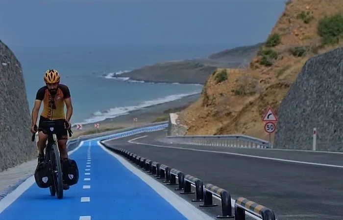
The total length of the 1st track of the 3rd stage of the Ephesus – Mimas cycling routes is 88.3 kilometers. The route, which starts from the intersection of Ildırı – Karaburun – Balıklıova roads and travels around the western side of the Karaburun Peninsula, passes over Akdağ to Karaburun; It intersects with the 7th stage in Balıklıova from above Mordoğan.
The total length of the 2nd track of the 3rd stage of the Ephesus – Mimas cycling routes is 31.2 kilometers. The route, which starts from Küçükbahçe Village, goes around the northern tip of the Karaburun Peninsula and intersects with the 8th stage in Karaburun.
The total length of the 4th stage 1st track of the Ephesus – Mimas cycling routes is 23.5 kilometers. It starts from EMY 1 route in İçmeler and merges with EMY 2 route in Urla. The highest point of the route is 223 metres.
The total length of the 5th stage 1st track of the Ephesus – Mimas cycling route, starting from the ancient Ionian city of Kolophon, is 43 kilometers. The route starts from Değirmendere (Kolophon), passes through Menderes district center and ends in Orhanlı. The highest point along the route is 226 meters altitude.
The total length of the 5th stage 2nd track of the Ephesus – Mimas cycling routes is 65.8 kilometers. It starts from the ancient city of Klaros in Ahmetbeyli and ends at the upper gate of the ancient city of Ephesus in Selçuk.
The total length of the 5th stage 1st track of the Ephesus – Mimas cycling routes is 53 kilometers. The route, which starts from Karakuyu Village and enters Selçuk from Belevi Village, intersects with the 14th stage. The highest point of the route is 107 metres.
Dia Urla is located in the center of Urla, 30 km from Izmir center and approximately 45 km from Izmir Adnan Menderes Airport; It is a family business. Our establishment, where you will feel the warm atmosphere with its stylish and elegant rooms carefully designed in line with the needs of its guests with 25 years of knowledge, experience and knowledge coming from the tourism and service sector, is a unique choice for accommodation in Urla.
